Imagine days of paddling on a narrow, lazy river. You snake through marshes and pine forests, passing by large boulders and tiny beaches. The land is full of herons and beavers, prints of a muskrat, or raccoon that reveal their passing. Each bend in the river takes you further into the wilderness. You reach a “development,” a campsite, or in its most advanced form, a lean-to. One might think that such a place is only in the Western United States or Canada. But, in fact, this magical land, the east branch of the Oswegatchie River, is in New York’s Adirondack Park.
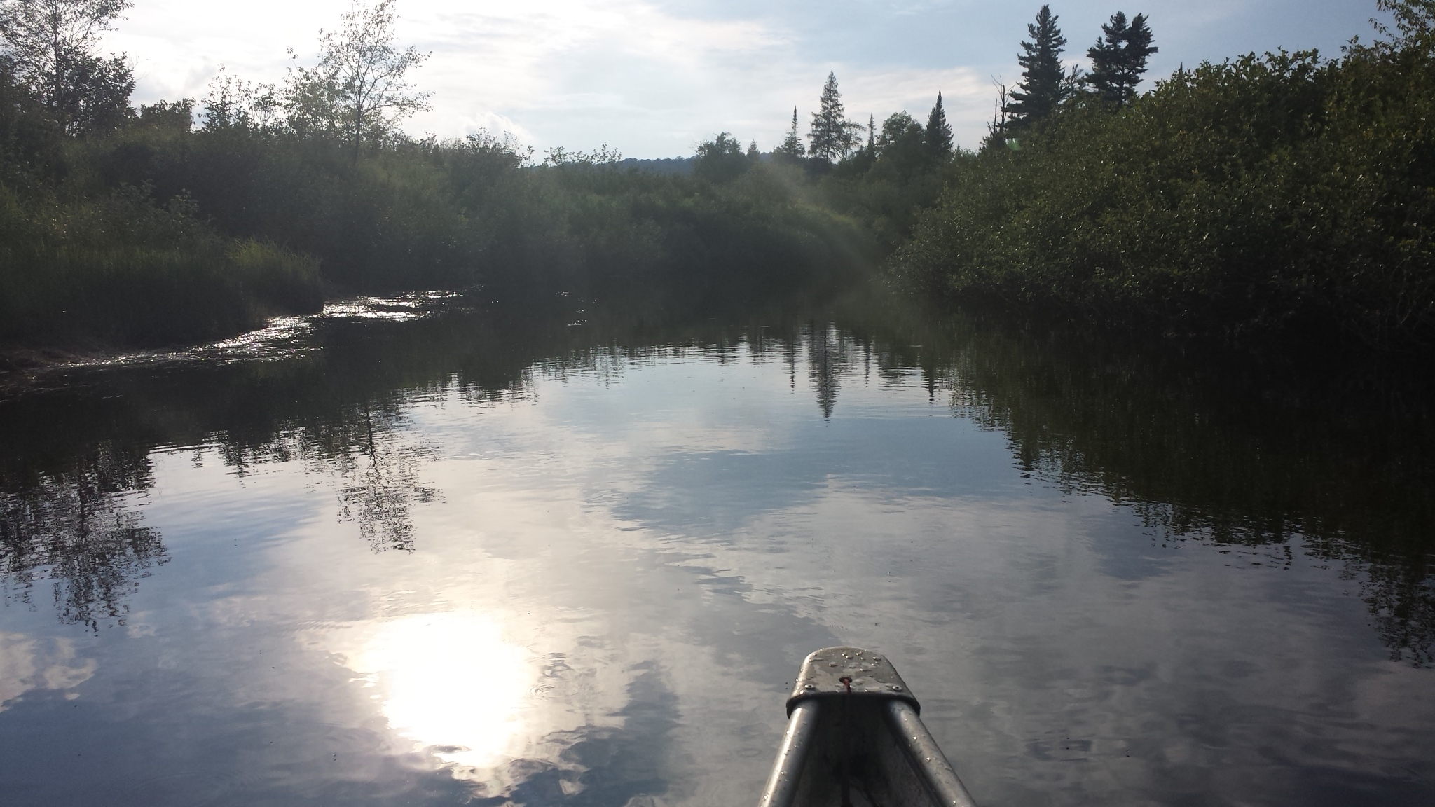
The Oswegatchie provides tranquility and a sense of solitude. Photo: Tim Moody
Getting To The Oswegatchie River
Accessing the Oswegatchie is a small adventure unto itself. South of the tiny tourist town of Cranberry Lake lies a hamlet called Wanakena, which from the highway appears to mostly consist of forest, picnic tables, hiking trails, and The Ranger School.
But, off of route 3 is a dirt road that leads back away from the highway for miles, deep into the woods, intersecting snowmobile trails. Abruptly, the road reaches the river and what appears to be a few seasonal homes. One of the camps is accessed by a footbridge that traverses the water. To the right, you’ll find the end of the road and a public parking area at The Inlet, a grassy area with river access. While The Inlet has an outhouse and camping is permitted, an hour of paddling on the river leads to spots that are far more secluded, wild, and peaceful.

One riverside beach on the Oswegatchie. Photo: Tim Moody
An Adventure on the Oswegatchie
One hot, August afternoon, my partner and I found ourselves at The Inlet, preparing to launch our canoe. The put-in has space to launch multiple boats simultaneously, which worked to our advantage. We happened to arrive as a large group was in the lengthy process of loading their canoes. However, we soon left them behind, and within 5 minutes, it seemed as though we had the river to ourselves.
We paddled upstream along bends and curves and through tall grasses. Small animals made paths to access the river, leaving holes in the meadows. In a few places, the water was low over the rocks. In those spots, I was glad to have a “beater boat” that I didn’t mind getting scratched up.
It turns out that the trip would be nearly impossible to undertake without scratching up a boat, especially this time of year. Motorized boats are not allowed on this section of the river. With the shallow water and frequent beaver obstructions, they would be completely impractical, regulations aside.
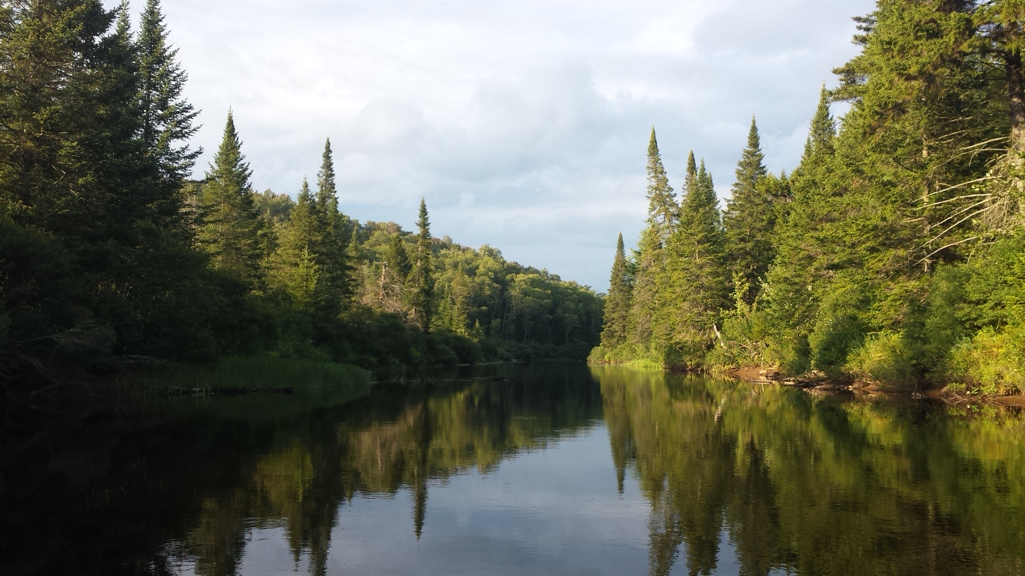
Inspiration around every bend. Photo: Tim Moody
Navigating The Curves, Bends, And Beaver Dams
Less than an hour upstream from The Inlet, we came to our first campsite. Under the pine trees that shaded the riverbank, we enjoyed a lunch break while gazing out on the water. The cool river, dark with tannins, was a refreshing spot for an after-lunch swim.
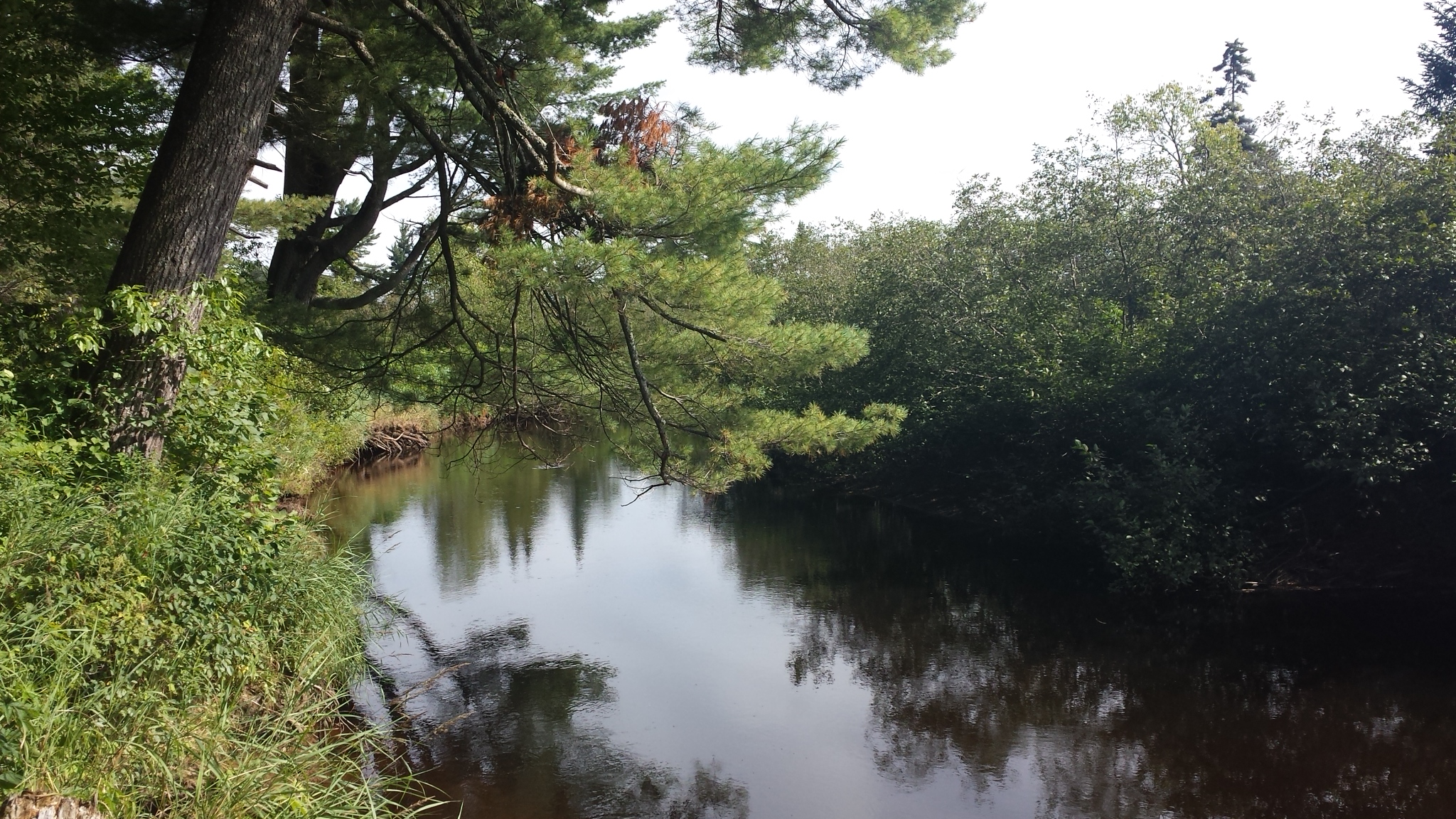
Then, back in the boat, we paddled upstream through many curves and bends as the river gradually narrowed. Though we passed a few other paddlers, the river never felt crowded. As we rounded the next turn, we had the place to ourselves again less than a minute later.
After one bend in the river, we discovered that we had arrived at High Rock. The Oswegatchie quietly flowed just next to a large boulder. The top of the rock boasts a campsite, set back in the woods. While High Rock would be an exceptional spot to spend the night, it was still early in the day, so we continued.
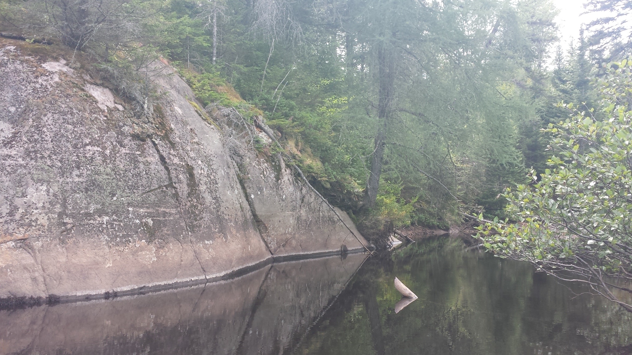
Heading downstream past a boulder. Photo: Tim Moody
Our Adirondacks Paddler’s Map- North listed Griffin Rapids as our next landmark. Aside from being listed on the map–an easy Class I section that didn’t require any hard paddling–the rapids were hardly noteworthy. The main difficulty of the day wasn’t even on the map.
Alternatively, the central problem of the day occurred before reaching our campsite at Buck Brook Lean-To. Here, I had to exit the canoe in thigh-high water and pull it over a beaver dam that we weren’t able to paddle up.
Thus, a good pair of water shoes and the ability to comfortably enter and exit the canoe in shallow water are a must for anyone undertaking this trip. The sheer number of beaver dams, especially further up the river, requires paddlers to get in and out of their boats often.
Read More: First-Timer’s Guide To Canoeing
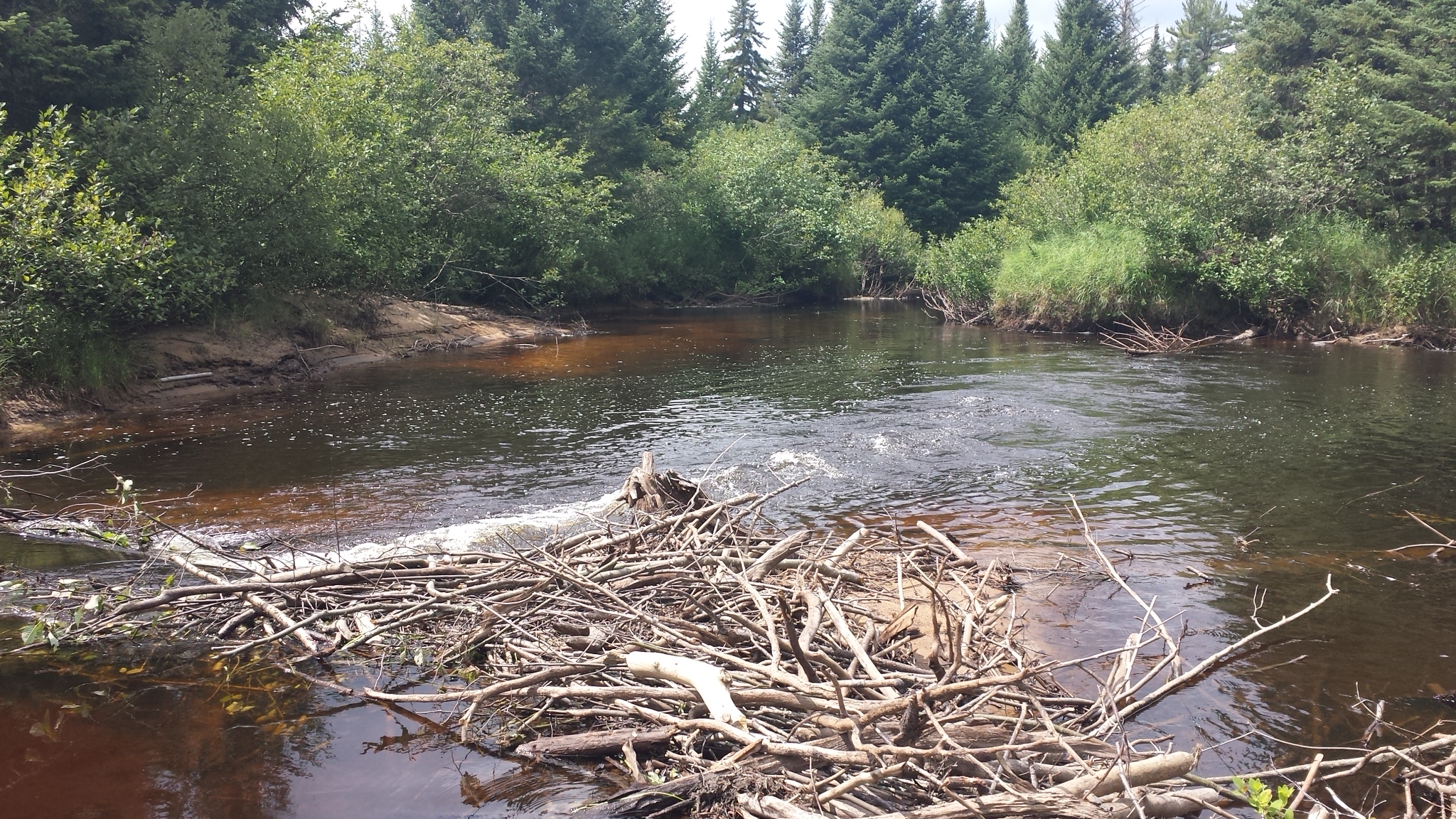
One of many beaver dams that tested our paddling skills (and patience). Photo: Tim Moody
Camping At Buck Brook Lean-To
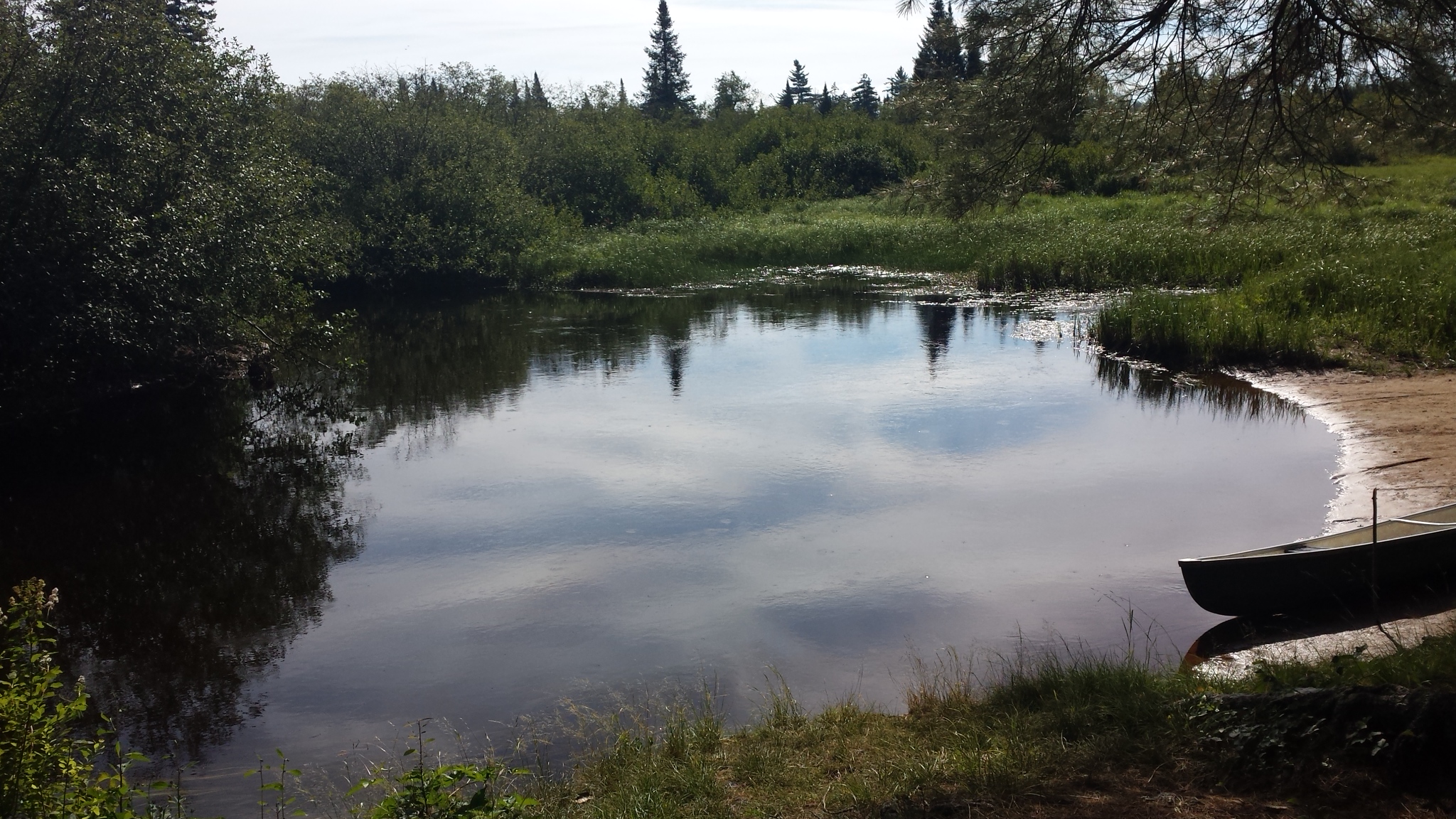
Buck Brook is one of several lean-tos along this section of water. From a bank along the outer edge of a river bend, the shaded lean-to looks out on the water. While the campsites along the Oswegatchie are numerous, they are spread out enough (except for those at High Falls) that each one feels completely private.
Mosquitoes descended upon us as we pulled out our boat. So we opted to pitch a tent rather than get eaten by the swarms around us. The shelter had an expansive view of Buck Brook and the marshland that surrounds it.
But, bears inhabit this section of the Oswegatchie River, at least according to our guidebook. So, as usual, we stored our food in a well-hung bear bag. Enjoying a fire in the pit by the lean-to, we had the site to ourselves. It was dark, and our eyes were focused on the glow of the fire when we heard a significant splashing noise in the water. We heard it once again and then no more.
Read More: Canoe Camping: Plan, Pack, Paddle
The view from Buck Brook Lean-To affords beauty with a sense of privacy. Photo: Tim Moody
The Journey To High Falls
The next morning, we ate breakfast with the early light glistening off of the water before getting underway. Paddling was more complicated than the previous afternoon. The river narrowed, less water flowed, and there were more frequent beaver dams. Some of the dams we were able to paddle up, while we had to haul the boat over others.
One of the campsites had some large river rocks and fast-moving water that required some spur of the moment route planning. Further upriver where the Five Ponds Trail crosses the water, we portaged around some rapids that we couldn’t muster the strength to paddle up.
Then, at another section slightly further upriver, we tracked the canoe up a very shallow part with swift water. The miles passed slower with all the obstacles, and we considered turning back several times, but ultimately opted to continue.
By early afternoon we had finally made it to High Falls, our final destination. While the river continues above the falls, a simple portage away, such a trip was outside the scope of our one-night trek. Contrary to its name, High Falls isn’t a particularly tall waterfall. However, it is an attractive feature and exciting to watch. Multiple flows diverge, and coverage at the multi-tiered falls.

Approaching High Falls. Photo: Tim Moody
After contemplating the waterfall for a few minutes, we were glad not to have turned back earlier in the day. The mist and breeze off of High Falls kept the bugs away, making it the best lunch spot on the river.
While visiting the waterfall is a worthwhile trip, camping near the falls may not be beneficial for those looking for solitude. With five campsites and a lean-to, High Falls is popular and a hub of activity. But, the advantage of staying near the falls, is these campsites have easy access to numerous hiking trails that explore the nearby ponds and mountain.
If you want to venture a short way downstream, though, there is a quiet, private campsite that would be my choice if I were to camp in the area.
After our lunch at High Falls, we prepared to head back to The Inlet. While we had another 13 miles to paddle on the return trip, the second half would be downstream. Being able to paddle over most of the beaver dams rather than having to haul the canoe over them saved a lot of time and hassle. I was also able to find lines down the two sections of rapids that we hadn’t been able to paddle up. But, the faster pace meant that sometimes I had to tell my partner to stop paddling so that I could steer us around the sharp bends.
During the last hour and a half on the river, we paddled hard to try to get off the water before a distant thunderstorm came too close. By the time we arrived back at the car, we were tired and sore. Although our trip was more rushed than I would have liked, I was still left with a sense of awe from the serenity and wildness of the place. Anytime I feel that sense fading, I know where I can go to find it again.
The beach at Buck Brook Lean-To is a refuge. Photo: Tim Moody
If You Go
Maps & Guides: The Adirondack Paddler’s Map North shows portages and campsites in the area. Pair it with the Adirondack Paddler’s Guide for more detailed descriptions.
Put-In: For this experience, we put in at the Inlet, near Wanakena. Find inspiration through 65 other flatwater adventures featured in Adirondack Paddling.
Classes & Water Levels: American Whitewater provides regularly updated water levels of various sections of the Oswegatchie River, along with the whitewater class of each section.
Camping: The Five Ponds Wilderness Area presents endless backcountry camping opportunities. Or, you can set up camp at the Buck Brook Lean-To and near High Falls. There are numerous primitive campsites along the Oswegatchie River to choose on your journey.
Would you paddle the Oswegatchie River? What are some of your favorite areas? Share with us in the comments below!
Article updated June 2, 2020
Read Next:
The Susquehanna River: History & Sports
How To Plan An Overnight River Trip With Kids
Doing The Dog Paddle: Tips For Canoeing & Kayaking With Dogs
Leave a Comment