
The Cape Fear River is formed by the confluence of the Deep and Haw rivers in southeastern Lee County. Its watershed is the largest in North Carolina, containing 9,000+ square miles. The Cape Fear begins in Greensboro and flows all the way to Southport, North Carolina, where it empties into the Atlantic Ocean. The mouth is located near shoals that are situated close by Bald Head Island.
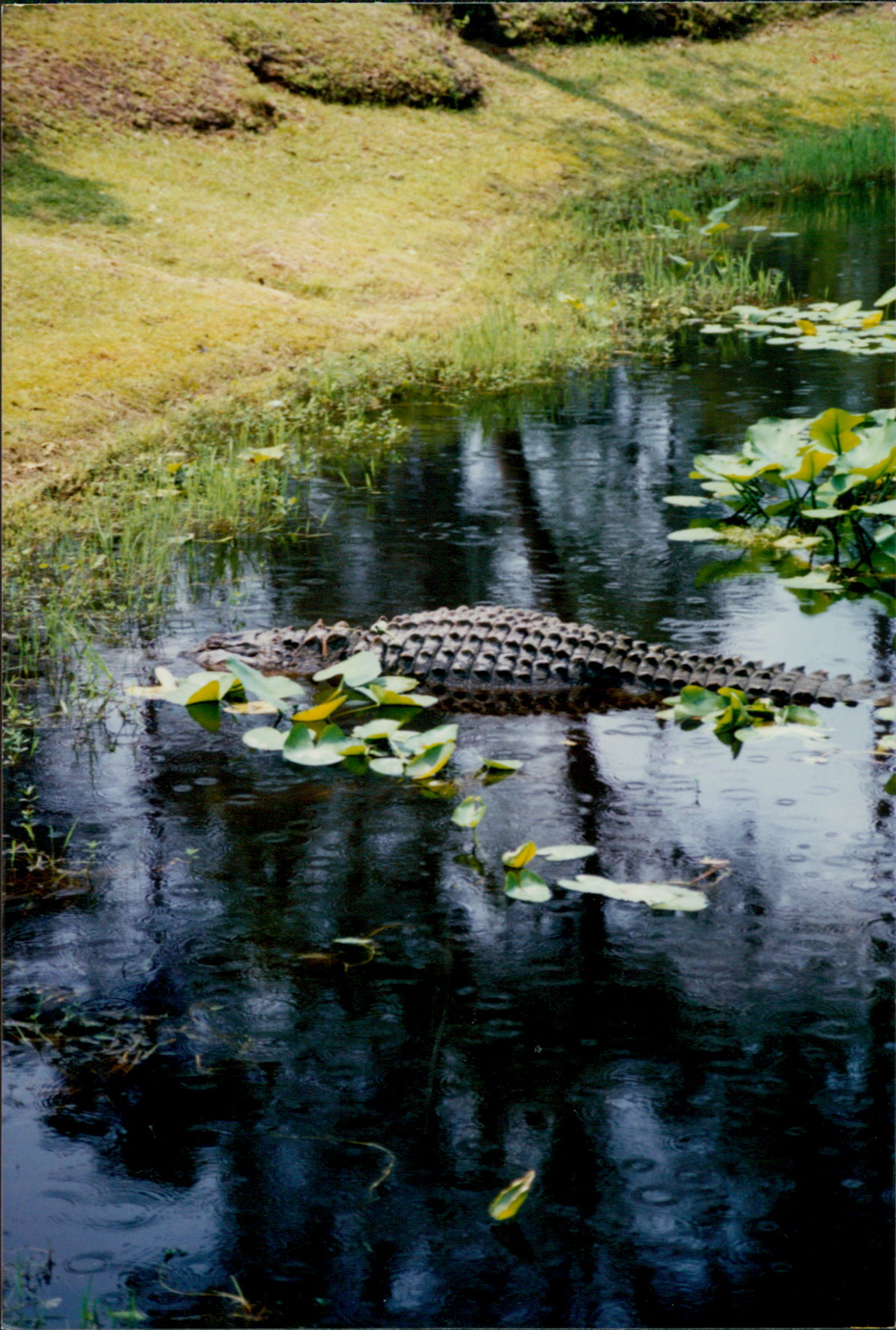
Alligators are often seen on the lower section of the Cape Fear River.
Access points every 10 miles or so provide many options on deciding which sections of the river to paddle. The lower section of the river–from Wilmington to Southport–can at times get rough because of the tide.
The Cape Fear River is a recreational resource that is overlooked by many people. In its flow to the sea the Cape Fear cuts through the heart of the state, containing in its drainage basin 116 towns in 26 of North Carolina’s 100 counties. The river is one of only four contained entirely within the borders of the Tarheel State and the only one that empties directly into the ocean. The Cape Fear has been a major artery of commerce, culture, settlement and war since the Italian explorer Giovanni da Verrazano (1485-1528) discovered it in 1524.
History
Few places in America are as rich in history as the Cape Fear River area. The river flows past farms and forests, over the remains of locks and dame built in the early years of the nation, past Revolutionary and Civil War sites.
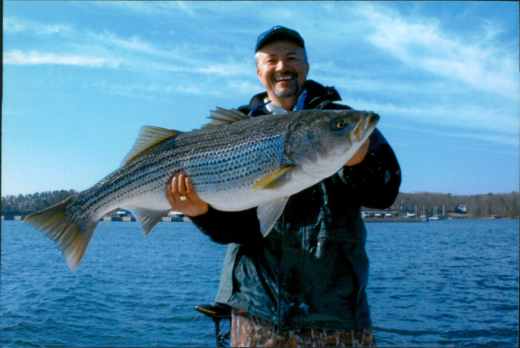
Striped Bass are a popular fish to catch most anywhere along the River and its bays.
Commercial travel on the Cape Fear River began in the mid-18th century with canoes, log rafts, and ships carrying lumber and livestock. Around Wilmington, especially, a vast amount of history is located along and near the river. The Cape fear is full of mysteries, from sunken ships to the oldest known living cypress trees, including a 2,500-year-old cypress located in the Three Sisters Swamp.
Whitewater
North Carolina has many streams that are paddled enthusiastically by canoeists and river rafters, some more than others. The degree of whitewater ranges from class IV or higher on some streams in the western part of the state, to coastal blackwater streams in the eastern part.
The first seven miles of the Cape Fear River consists of flatwater backed up behind an impoundment known as Buckhorn Dam. Below Buckhorn Dam I entered the whitewater section of the Cape Fear that extends downstream 24 miles. Here the river elevation drops 70 feet. Off to the southwest begins the Sandhills Region, which abuts the river with high bluffs. The best known of these bluffs is found in Raven Rock State Park.

Loggerhead sea turtles return to Bald Head Island each summer to lay their eggs.
The river has one public campground at the park near Lillington (sites are for canoeists only). Here are found a few class II rapids but the rest are class I. In this section the Cape Fear averages 250 feet in width.
What to See and Do
The Cape Fear area offers wonderful opportunities for observing migratory birds, other wildlife and rare plants. Fishing for bass, sunfish and catfish can be excellent. For persons with an interest in history, evidence of past steamboat activity is occasionally visible. Keep an eye open for otters, alligators and an occasional black bear.
For the experienced canoeist, the lower Cape Fear holds some wonderful surprises. Paddlers who frequent these waters have been known to gather wild rice that was cultivated by long-vanished rice plantations.
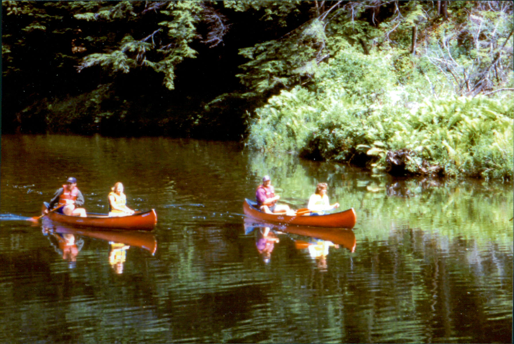
Canoeing along the Cape Fear River is a popular activity.
The mouth of the Cape Fear River at Southport creates the Cape Fear Inlet. Locals and visitors alike have hailed Southport as one of the most unique coastal communities to be found anywhere. The village is a stunning combination of historic residences, lush coastal landscaping and miles of water in every direction.
Experienced paddlers can explore the Cape Fear area on their own or have a local guide lead the way.
One main feature of the Cape Fear River is the cypress tree. Some of the cypress trees seen here are over 1,500 years old. I will never forget the entrance to the Three Sisters Swamp. It is a small aquatic door into a water forest. Soon after entering a canoeist is overpowered by giant trees, extraordinary colors and an intense intimacy with nature.
Raven Rock State Park is located near the town of Lillington along the banks of the Cape Fear. An immense crystalline structure rises to 150 feet and stretches for more than a mile along the river. In 1854 it was named Raven Rock, inspired by the sight of ravens that roosted on rock ledges.
Scottish emigrants were among the first Europeans to reach the area. They were mainly hunters and trappers who were looking for the type of mountainous countryside that resembled their homeland. Later settlers to the area cleared the forests, sold the timber and established farms.
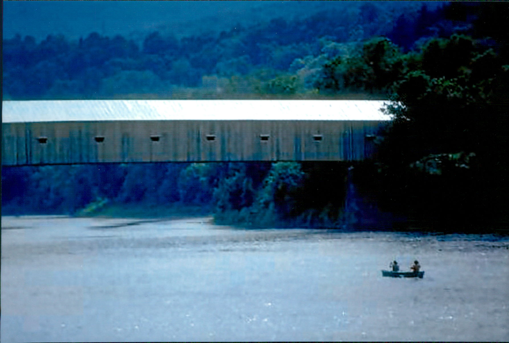
Canoeing beneath a covered bridge.
Warning
Check water levels before heading out. Water should be at least 1.3 feet deep for paddling. Do not go on the river during bad weather as choppy water can make paddling dangerous.
An ever-present danger on the Cape Fear is foot entrapment. Your feet can get snagged between underwater rocks, the current rushes you downstream with your head underwater and you drown because, with the tremendous force of the water tugging you tighter into the rock’s grip, you cannot break free of the rocks. Always make certain when you’re in the Cape Fear River that your feet are forever unencumbered by rocks.
Leaping fish, wading herons and circling birds of prey await you on a Cape Fear River trip. Beginning canoeists and kayakers will enjoy a trip here, as will seasoned paddlers seeking a quiet sort of excursion. The upper reaches of the Cape Fear and the winding creeks of the coastal plain offer a taste of the old Southeast to those with small boats, kayaks or canoes. What I like best is the spirit of adventure that a paddler finds here. In a world dominated by such names as Microsoft, Google and Facebook, it’s encouraging to know that nature still holds distinct sway over places where lovers of the outdoors enjoy congregating. Enjoy and do plan on returning.
Leave a Comment